| Ground Directions | Air Navigation | Home |
High Flights is easy to find both on the ground and in the air.
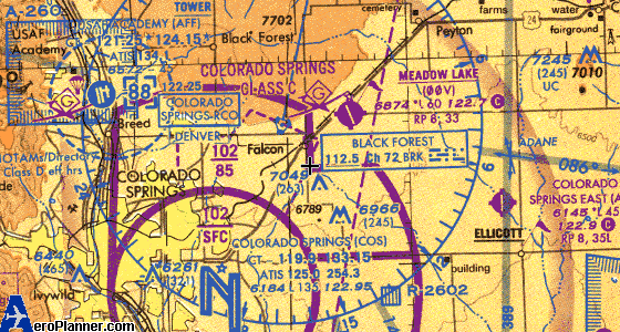
From the north end of Colorado Springs go east on Woodmen Avenue to its end at Highway 24 in the little town of Falcon, and turn right onto Hwy 24. Falcon Hwy is about a mile down the road toward Colorado Springs, on your left. Or go east on Platte Ave./Hwy 24 past Peterson Field, or east on Constitution Ave., and continue up Hwy 24 to Falcon Hwy, just past Falcon Meadow RV Campground. Go east on Falcon Hwy to approximately Good Fortune Road. On the north side of the Highway opposite Good Fortune Road is a gate. Pass through the gate and follow the car tracks to the HFSC trailer. Do not drive onto the turf strip; it is a mowed turf runway outlined with the occasional tire. Drive carefully; if you have not been here before, landmarks are not always obvious.
Please see this image. (Sorry the image is on FB at this time, we're having trouble with our sftp configuration. We'll get it posted "inline" asap.)
If the gate is closed, we are not open. Sorry!!
If it is near opening time, you are welcome to wait for us where it is safe.
If you know the combination, please open the gate and come on in.
If you are the last one out, please be sure the gate is locked.
If you are not sure you are the last one out, lock the gate.
High Flights' mailing address is in the banner at the top of our home page.
| Top | Home |
| Top | Home |